Tropical cyclone Chido devastates Mayotte in Indian Ocean
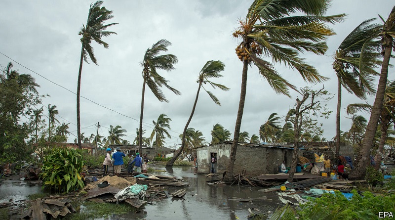
The South-West Indian Ocean (SWIO) tropical cyclone season has got off to an early and devastating start. Intense tropical cyclone Chido, the third named system, made a direct hit on the French overseas department of Mayotte with catastrophic consequences for the population.
Chido hit Mayotte on 14 December with wind speeds of more than 200 km per hour, and gusts of more than 225 km/h. It was the strongest storm to hit Mayotte in at least 90 years, according to Météo-France.
Torrential rainfall accompanied the winds – 176 mm in 12 hours – as well as dangerous seas with average wave heights of more than 5 meters. Such was the strength of the cyclone that it destroyed some of Météo-France’s observational structure.
French President Emmanuel Macron declared national mourning. A massive emergency and relief operation was mobilized as early reports warned that hundreds of people may have lost their lives on the small island which is unaccustomed to such strong tropical cyclones and where there are many informal housing structures.
The heavy loss of life occurred despite accurate and timely warnings from Météo-France more than 50 hours in advance. The amber alert was issued on Friday 13 December at 7am local time, red alert on Friday 13 in the evening, upgraded to a rarely used violet alert on Saturday 14 at 7 am.
Chido took an unusual track – it skirted the larger Indian Ocean island of Madagascar which would potentially have weakened the system. Its impacted Mayotte as an intense tropical cyclone, with its eye completely engulfing the small island.
Chido subsequently made landfall over Mozambique on 15 December before weakening. It brought heavy rainfall to both Mozambique and Malawi.
Météo-France said that the role of climate change was unclear.
“The impacts of Chido are above all due to its track and the direct hit on Mayotte,” commented Météo-France on its website. “This is an extremely rare event not seen for 90 years. Our current state of knowledge doesn’t allow us to draw any conclusions about the role of climate change on the track of the cyclone and on its intensity,” it said.
Météo-France La Réunion acts as WMO’s Regional Specialized Meteorological Centre (RSMC) Tropical Cyclone center for the South-West Indian Ocean.
The RSMC’s seasonal forecast for the region, issued on 31 October, accurately predicted an early start to the 2024-2025 cyclone season. In the previous three seasons, the first impacting systems only happened in January. The seasonal outlook said these potential impacts could begin earlier, possibly before the end of 2024.
The 2024-2025 cyclone season in the Southwest Indian Ocean is expected to be characterized by near normal to above normal activity , with 9 to 13 systems predicted, of which four to seven may reach tropical cyclone stage, according to the outlook.


